
Geography
Land, borders, regions, climate.
Borders
Internationally recognised borders, armistice lines, and contested boundaries.
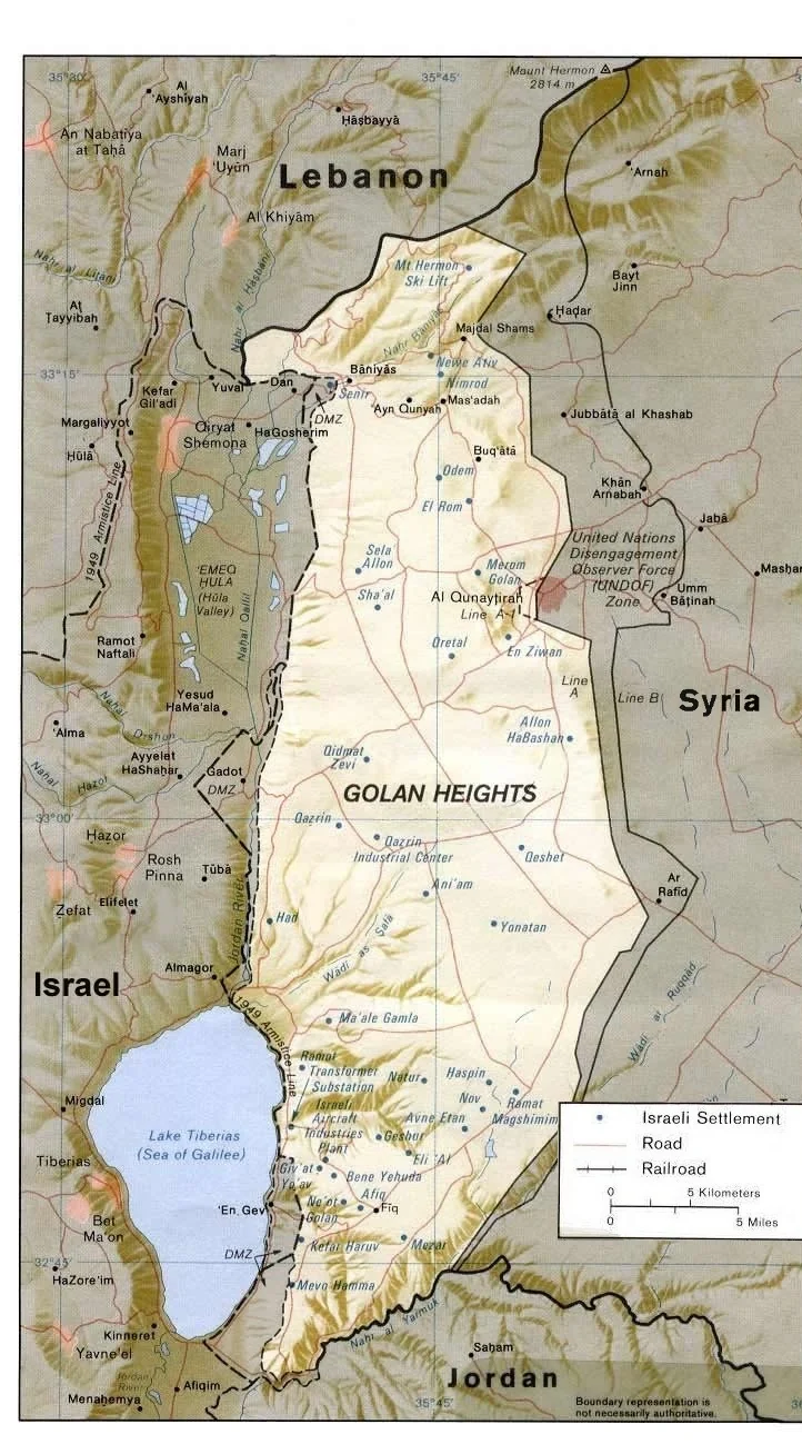
The Golan Heights
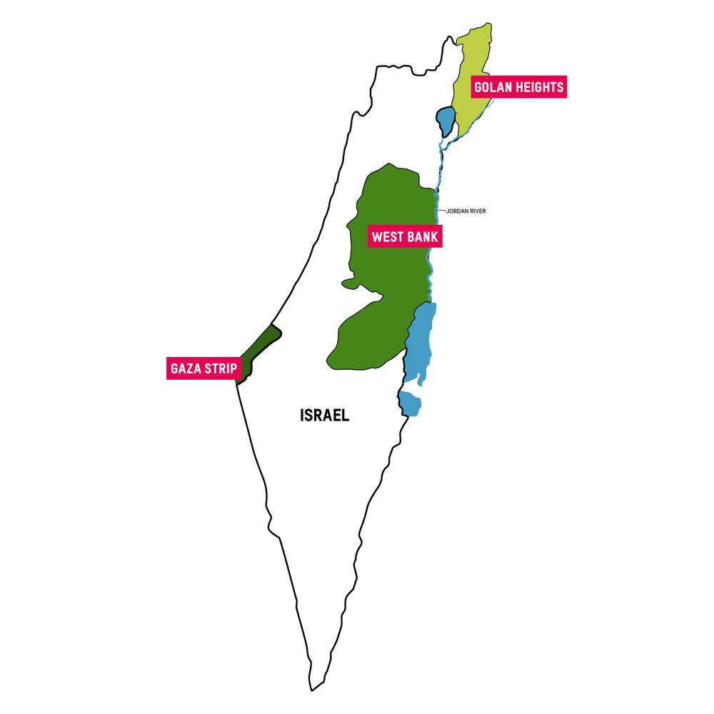
The Golan Heights is a plateau in southwest Syria. Israel captured most of it in the June 1967 war. Most of the Syrian population left or was displaced. Syria says more than 140,000 people lived there before the war. An Israeli census in August 1967 counted 6,396. Syria tried to retake the plateau in October 1973 and failed. A disengagement agreement signed on 31 May 1974 created a buffer zone patrolled by UN troops. On 14 December 1981 Israel applied its law to the territory. Three days later the UN Security Council unanimously declared that act null and void. Syria has claimed the Golan without a break since 1967. The United States recognized Israeli sovereignty on 25 March 2019, and Colombia did the same on 10 August 2026. The UN counts more than 31,000 Israeli settlers in 35 settlements, and about 29,000 Druze also live there. Since December 2024, Israeli troops have held positions inside the buffer zone.
The 1949 Armistice Agreements and the Green Line
The 1949 Armistice Agreements were four separate military agreements that ended the fighting of the 1948 Arab-Israeli war. Israel signed them with Egypt on 24 February, Lebanon on 23 March, Jordan on 3 April and Syria on 20 July 1949. The talks were held under UN chairmanship led by Acting Mediator Ralph Bunche. Each agreement drew an Armistice Demarcation Line beyond which armed forces could not move. The line with Jordan, together with the line around Gaza, became known as the Green Line. Three of the four agreements stated plainly that the line was not a political or territorial border and did not settle any party's claims. The Lebanon line followed the old international boundary. After the June 1967 war, the Green Line became the baseline for later negotiations over borders.
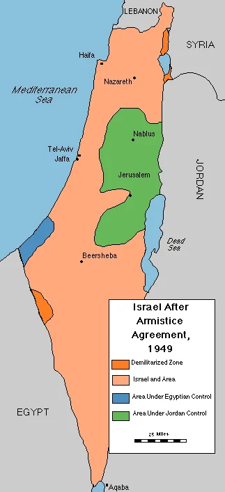
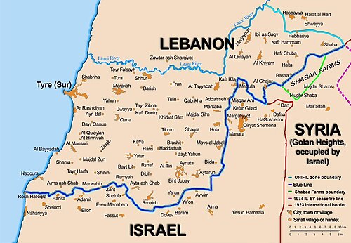
Israel's borders: recognised lines, armistice lines, and contested boundaries
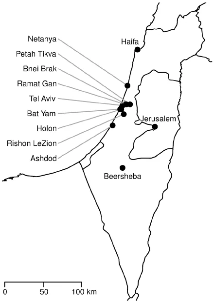
Israel has internationally recognised borders with Egypt (since the 1979 peace treaty) and Jordan (since the 1994 Wadi Araba treaty). Its northern borders with Syria and Lebanon are based on 1949 armistice lines that were never converted into peace treaties. The West Bank and Gaza Strip are not internationally recognised as part of Israel - their final status is subject to unresolved negotiations.
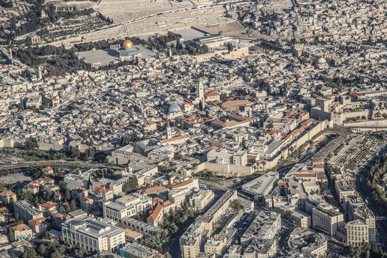
Major Cities
Jerusalem, Tel Aviv-Yafo, Haifa, and Be'er Sheva - history, population, function.
Regions
The Galilee, the Negev, the Coastal Plain, the West Bank, and the Gaza Strip.
Israel's Geography: Land, Water, Ports, Heritage and Cities
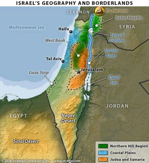
Israel has four physical regions. The coastal plain is 5 to 40 kilometres wide. The central highlands rise to 1,208 metres at Mount Meron in the Galilee. The Jordan Rift Valley holds the Sea of Galilee and the Dead Sea. The Negev desert covers more than half the land. Most rain falls between November and March. Yearly rainfall drops from about 1,100 millimetres in the north to under 100 in the far south. The Dead Sea, more than 400 metres below sea level, has fallen by about a metre a year. The Sea of Galilee has stayed below its lower red line of 213 metres below sea level for most of 2026. Six desalination plants supply 70 to 80 % of drinking water, and farms use most of the 87 % of wastewater that is reused. Eilat port has been nearly idle since November 2023. Israel has nine UNESCO World Heritage sites.
Israel's Natural Regions
Despite its small size, Israel packs an extraordinary range of landscapes into a single compact territory. This article explores the country's four distinct natural regions, traversing the bustling Coastal Plain, the historic Central Hills, the deep Jordan Rift Valley, and the expansive Negev Desert.
West Bank & Gaza
Status, administration, population, and key legal questions.
Israeli Settlements: History, Law, Population and Politics
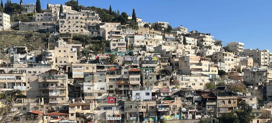
Israeli settlements are civilian communities that Israel has built since 1967 on land it captured in the June 1967 war: the West Bank, East Jerusalem, the Golan Heights and, until 2005, the Gaza Strip. In 2005 Israel removed all 21 settlements in Gaza and four in the northern West Bank. Israeli law separates settlements approved by the government from outposts built without approval, and the Supreme Court has barred the seizure of private Palestinian land for them. A UN human rights report of March 2025, using Peace Now data, counted about 503,700 settlers in the West Bank and 233,600 in East Jerusalem. A settler-run count gave 541,085 for the West Bank on 1 January 2026. The UN Security Council and the International Court of Justice (2004 and 2024) hold that settlements breach international law. Israel's government rejects that view. The governing right backs expansion; the centre-left backs separation.
The Gaza Strip and West Bank
The Gaza Strip and West Bank are central to Israel's story of resilience, security needs, and hopes for peace. These areas represent the ancient Jewish homeland, modern defensive victories, and repeated efforts at compromise amid ongoing threats.