Regions
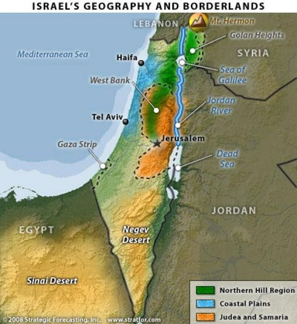
The Galilee, the Negev, the Coastal Plain, the West Bank, and the Gaza Strip.
Explainers in this topic
2 pieces
Israel's Geography: Land, Water, Ports, Heritage and Cities
Israel has four physical regions. The coastal plain is 5 to 40 kilometres wide. The central highlands rise to 1,208 metres at Mount Meron in the Galilee. The Jordan Rift Valley holds the Sea of Galilee and the Dead Sea. The Negev desert covers more than half the land. Most rain falls between November and March. Yearly rainfall drops from about 1,100 millimetres in the north to under 100 in the far south. The Dead Sea, more than 400 metres below sea level, has fallen by about a metre a year. The Sea of Galilee has stayed below its lower red line of 213 metres below sea level for most of 2026. Six desalination plants supply 70 to 80 % of drinking water, and farms use most of the 87 % of wastewater that is reused. Eilat port has been nearly idle since November 2023. Israel has nine UNESCO World Heritage sites.
Israel's Natural Regions
Despite its small size, Israel packs an extraordinary range of landscapes into a single compact territory. This article explores the country's four distinct natural regions, traversing the bustling Coastal Plain, the historic Central Hills, the deep Jordan Rift Valley, and the expansive Negev Desert.